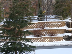
Winter of 2013-2014 has been a good starter, with below freezing temperatures hitting earlier than normally expected. In October, the temperatures hit freezing around the end of the month in the midwest. Some forecasts for the winter of 2013-2014 were signaling for a quicker start to the winter, for a full freeze by November 5th. The forecasts were straight away correct, showing signs of cooler weather around October 25th. By November 10th, the first strains of snow were showing signs, and many home owners worried they could adequately prepare for winter, and its long sleep.
Winter of 2013-2014 Starts and Stops
 Around the beginning of November, freezing temperatures, and brisk winds began be very simply part of the climate. No doubt about it, winter was arriving. With this advent, new threats of tornadoes began to rise, and many people lost their homes in the middle of the country. With even colder weather behind these freakish fronts, the task of clean-up was very difficult indeed. With the warm days of October, and now the cold weather of November, it was difficult to know when lawns could be put to bed, and bulbs planted before they would attempt to grow again. On Thanksgiving, November 27, 2013, Minnesota and Wisconsin experienced a really warm day, with just enough gusty winds to forecast things to come. In fact, this was the last warm weekend, with snow and freezing weather remaining on the early part of December.
With the advent of the holiday season, the winter weather was welcome to most people in the midwest, and they began the preparations for the end of the year holiday season. Often looking for a white christmas, many people were thrilled to see over 15 inches in Central Minnesota for year end of winter of 2013. Wisconsin and Illinois saw even higher totals of 20 to 25 inches of snow with colder temperatures holding the totals solid. A two day stretch of warmer weather, above freezing, around December 18, 27 and 28th, showed Minnesota a break in the freeze, and some road ways were slippery due to the freeze thaw pattern.
Warmer Weather Ends For Winter of 2013
With the last of the above freezing days, December of 2013 has been one of the coldest months recorded, ending a record of cold weather dating back to 1970. Continued cold weather from December 4, 2013 thru December 17, 2013 was the longest stretch of very cold temperatures and light snow Minnesota and Wisconsin has seen since that era. With the break in the temperatures around December 18th, that change felt very good to us all, and was welcomed. With the day passing, however, the cold weather returned on December 20th, in the early morning, and lasted for one week. Very cold temperatures, did not forget to bring precipitation, as the fronts were different enough to warrant more accumulated snow.
Northern Minnesota’s Snowiest Winter of 2013
In Duluth, Minnesota, and Superior, Wisconsin, there have been over 45 inches of snow so far this winter of 2013, with most of the snow falling between December 2-4, 2013. That snow fall dropped close to 30 inches of snow around the upper parts of Minnesota, Wisconsin and the Upper Peninsula of Michigan. The region is now at a point, if they get more than 3 inches of snowfall, by the end of the year, they will have the snowiest december on record. Sometimes meeting the record is an accomplishment, but in terms of weather, this will only hold for a very deep precipitation melt off in the spring, and Lake Superior will see good returns on this weather.
Look for extremely cold weather towards the end of the winter of 2013, beginning 2014 with temperatures around 27 degrees below zero on New Year’s eve. What a way to end a year and a winter of 2013.
